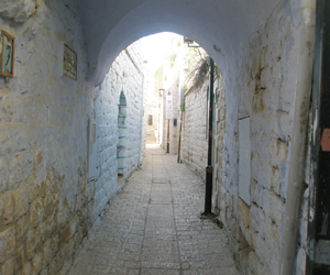
Restoring The Citadel Site
Thanks to the Conservation Department of the Israel Antiquities Authority, Citadel Hill in the city of Safed has undergone significant development and restoration. Citadel Hill is an important urban landmark. It is situated at the hub of the old city of Safed and holds center stage as it commands the highest point of the highest city in the land. All this serves to give the site the characteristics of an acropolis.
Iconoclastic Nature
In its present incarnation, the locale serves as a visible monument to the city's history as well as underpinning the iconoclastic nature of Safed, juxtaposed as it is with a modern city center and a heavy concentration of Orthodox Jewish residents. The unique landscape of the Citadel provides visitors and residents alike with a breathtaking view and a large green area for picnicking.
The archaeological analysis of the various components of the Safed citadel is a massive project still in its infancy. In the northern part of the complex alone, archaeologists have exposed a round tower, attributed to the Beibar ruler Salah-a-din's conquest of the citadel in 1188, as well as a bell-shaped cistern. Below this is situated a Crusader water cistern, along with an inner wall and arrow loops. Further on is a gate tower and ramp from the Mamluk period along with a hidden underground passageway.
Observation Points
When Israel declared statehood in 1948, the Crusader and Mamluk citadel remnants were used as the backdrop for a city park, which was designed by Shlomo Oren, a landscape architect. Besides its green areas and flora, the park provides observation points for viewing vistas both far and near, as well as a memorial to the War of Independence soldiers who fell in the line of duty.
Fortifications in Safed dating back to the time of the Second Temple period are in evidence but the remains which are now visible are from the Crusader, Mamluk, and Ottoman times. Aiding those involved in the restoration process are documents covering two periods of history. The bishop of Marseilles, Benova D'Avigone gave a detailed description of fortifications systems as they were in the mid 13th century CE. Shams A-Din al Otmani provides similar information relating to the additions created by the Mamluks in the latter half of the century.
Massive Earthquake
Based on this detailed evidence, scholars believe the fortress comprised an area of some 40 dunams, and included two defensive rings. The fortress itself was encircled by seven defensive towers, with two more towers having been added after the Mamluk victory over the Crusaders. After a massive earthquake struck the city in 1837, the citadel no longer served any useful function and was plundered by locals for building materials needed to restore earthquake-damaged homes.
Today
Thanks to the restoration project, completed in 2014, visitors can enjoy walking along the trails that wind around the citadel park. There are public bathrooms and a playground at the summit of the citadel, as well as unique foliage and beautiful views of the Kinneret to the east and Mt. Meron to the west.